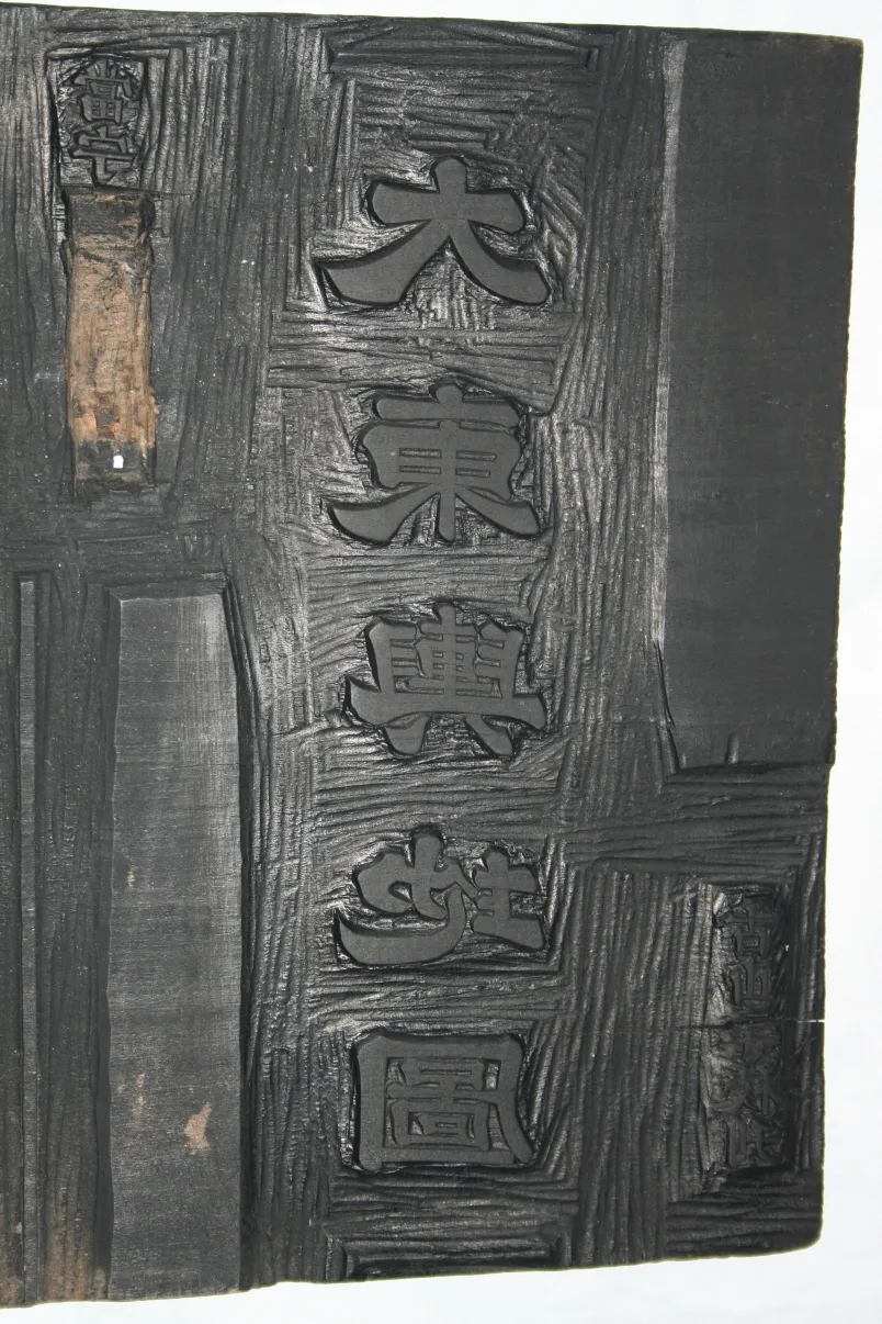
Daedongyeojido Woodblocks
大東輿地圖 木板
서울특별시 용산구
Basic information
- Designation
- Treasure No.1581
- Category
- Craft
- Era
- 19세기
- Designated year
- 2008
- Location
- 용산구, 서울특별시— 서울특별시 용산구 서빙고로 137 (용산동6가, 국립중앙박물관)
- Coordinates
- 37.524041, 126.980350
AI Docent
Coming soonAn AI-generated, friendly retelling of this heritage site is available in Korean. An English version is on our roadmap — for now, please see the official description below.
Description
These are 11 out of the total 12 printing blocks for Daedong yeojido (Map of the Great East), which are known to exist today. The Map of the Great East is the largest and most scientific map of the country made during the Joseon Dynasty. The printing blocks are made of wood from some 100-year-old linden trees. Each block is carved on both sides, each side with geographic information about an area some 120 ri from north to south and 160 ri from east to west (1 ri approximately equals 400 meters). Empty spaces on blocks for coastal areas or islands have maps of other areas, raising the utility of every block. The map is the magnum opus of Kim Jeong-ho (1804-1866), the father of Korean cartography, who used the pen-name Gosanja, meaning the “Old Mountain Man.” The map occupies a paramount position in the history of Korean science.
Location
지도를 불러오는 중…
Have you visited this place?
Log in and verify your visit on-site via GPS to record a stamp in My Journey. (QR verification coming later.)
Images: KOGL (khs.go.kr) · Data source: Korea Heritage Service Open API (khs.go.kr)